










Oxford, England and Oxford, Mississippi are an ocean apart, but both use ArcGIS to connect location data and make smarter decisions. Proof that you don’t have to be a big city to make a big impact. Learn more: bit.ly/4BluW3I

Want to tell a geospatial story that makes an impact? 🌎
Get advice from the 2026 @ArcGISStoryMaps Competition judges on using maps and GIS to inform, inspire, and drive change. bit.ly/3VaHnyW
#StoryMaps

ArcNews, is that you? 👀
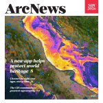
The redesigned magazine brings together stories from the Esri user community and practical ideas for GIS professionals of all skill levels.
Read the latest issue: bit.ly/4ihyHzH

Boo! 💀 Did we get you?
Give your maps a spooky twist this Halloween. See how layers and symbology can bring a little Halloween spirit to your cartography: bit.ly/4slncKI
From Down Under to the Sunshine State, cities use ArcGIS to connect location data, reveal insights, and make better decisions. No matter the size, ArcGIS helps governments innovate, adapt, and thrive. See how: bit.ly/4BluW3I

Your plans for @gisday? Consider them mapped! 🗺️
Celebrate the innovators, problem-solvers and storytellers using GIS to make a difference. Register your event: bit.ly/3EgaQcF
Plus, event hosts receive three free ArcGIS for Personal Use licenses.
#GISDay2026


Show your support for geospatial literacy! National Geographic MapMaker, powered by Esri, is an Anthem Awards finalist. Cast your vote in both categories. #AnthemAwards
🔸K-12 Education Innovation: bit.ly/4zLO75g
🔸Education or Literacy Platform: bit.ly/4hXetek

How do you become a cartographer?
What makes a map good? 🗺️
Why a woodshed?
Ask Esri cartographer @John_M_Nelson during our upcoming GIS Week AMA. Tune in on November 17th!
Register now and share your questions in the comments: bit.ly/47XCuMl
Where will it flood? The National Water Center’s new high-resolution flood prediction maps answer that for nearly the entire US population. Now in ArcGIS Living Atlas. @nwsnwc
🔗: bit.ly/4rFTz6D
What's the most valuable insight you use when evaluating a market?
📍Demographics
🛍️ Consumer spending
🚗 Traffic patterns
🏪 Competitor analysis
Learn how ArcGIS Business Analyst helps turn location data into smarter decisions. bit.ly/4qRvdX7
Ever watched a @John_M_Nelson video and wished you could ask a follow-up question? Now's your chance! 🙌🏽
Join us for a live AMA with Esri cartographer John Nelson on Nov 17.
Comment your questions below.
🔹Register: bit.ly/4hWYJH1

Ever seen a map that makes you want to lace up your boots? 🥾
This shaded-relief map brings one of Alaska's most iconic backcountry routes to life, blending GIS, cartography, and alpine artistry into a stunning visual experience. bit.ly/4ddL0tW
🗺️ Abigail McHenry

Seeking a screen-free, creative activity? 📵
“Color Me Mappy: A Cartographic Coloring Book” invites you to interact with maps in a tactile, hands-on way.
Transform iconic, real-world places into immersive coloring experiences: bit.ly/4p6nX8U

ALT Color Me Mappy book by Molly Green-Hogeweg on a green topographic background with maps of India, Petra, and London nearby.
Want a fast way to get started with GeoAI in ArcGIS? We'll give you 13. These beginner-friendly tutorials will put you on the path to becoming a deep learning model master: bit.ly/4dH1rQo
Already using GeoAI? Drop your favorite model in the comments.


New terrain analysis capabilities are here! ⛰️
With ArcGIS Maps SDKs for Native Apps 300.1, you can now calculate slope and aspect from a raster, making it easier to build apps that analyze and visualize terrain.
🔹Learn more: bit.ly/4jiJytX

Point Reyes National Seashore is home to one of California's most dynamic coastal ecosystems. Explore how rising seas could reshape rocky intertidal habitats and the species that depend on them in the story map, Rise & Tide. 🌊
🔗: bit.ly/4bVE9ok

From data to action. 💧🗺️
Discover how hydrologist David Maidment uses GIS to advance water and forecasting in “Geowater: A Geographic Approach to Water Data and Forecasting”. Part of The Power of Where Collection.
🔹Explore the book: bit.ly/4pC0D3i

ALT A 3D image of the book “Geowater: A Geographic Approach to Water Data and Forecasting” appears next to a sample page titled, “The Weight of Water”.
The Mediterranean Sea is home to 17,000 species, but many are under threat. Now, a team of independent scientists is using GIS to shine a light on these endangered species and help shape smarter policies that safeguard the Mediterranean’s sea life.🪸 ow.ly/2xNV50XU6Pp
