
Official X account for @NOAA's National Weather Service. A list of official NWS accounts can be found at https://xitter.twitterapi.xyz/t.co/nG1wK2Kcru
- Tweets47.3K
- Following323
- Followers3.2M
- Likes10.8K





ALT Forecast graphic showing increasing probabilities for minor impacts from snow across the central Appalachians and the interior Northeast later this week into the weekend.

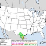
ALT Severe Weather Outlook for Texas on Tuesday, November 10, 2026, showing marginal to slight severe thunderstorm risk concentrated along the Gulf Coast from Corpus Christi through Victoria and Houston to Galveston, with city labels, state boundaries, a risk legend, and NOAA/SPC logo.

ALT Winterize your home. Inspect your chimney. Caulk and weather strip doors/windows. Insulate exposed pipes. Insulate your attic. Clean out gutters. Install and test smoke alarms and carbon monoxide detectors (with battery backups). Gather supplies.


ALT Confidence is high that a low pressure system will develop across the Ohio Valley Wednesday and then shift off the Mid-Atlantic coast while strengthening Friday. Trends in the model guidance suggest a slightly faster system with less overall precipitation. The threat for at least some impactful high elevation snow remains, but the risk has decreased in lower elevations. The exact placement of the storm — small shifts in the track will greatly change impacts. The amount of snow that may occur, and what impacts will result from this snow. The impacts to coastal regions due to gusty winds and onshore flow. Confidence in storm development remains high, but details will continue to adjust. The threat for low elevation snow has decreased, but high elevation snow and coastal impacts are likely. Keep up to date with the latest at weather.gov

ALT Heavy to excessive rainfall is possible over southern Texas today. A slight risk (level 2 of 4) for excessive rainfall has been issued for today along the coastal region of south Texas.

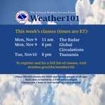
ALT National Weather Service Weather101 flyer promoting free online classes — Mon Nov 9: 11 am The Radar, 8 pm Global Circulations; Tue Nov 10: 8 pm Tsunamis — register at weather.gov/ohx/weather101; classes hosted by NWS meteorologists, about 1 hour with Q&A.

ALT WHAT WE KNOW: A wave of low pressure is likely to develop across the Ohio Valley late Wednesday and then track eastward to off the Mid-Atlantic coast Friday while strengthening. This low pressure will cause expanding precipitation, with rain and high elevation snowfall possible. Much cooler than normal temperatures will accompany this system Friday and through next weekend. WHAT WE DON’T KNOW: The exact placement of the storm — small shifts in the track will greatly change impacts. The amount of snow that may occur, and whether lower elevations will receive any accumulation. The impacts to coastal regions due to gusty winds and onshore flow. BOTTOM LINE: Confidence in storm development is higher than confidence in specific impacts. Forecast details will change over the next several days. Keep up to date with the latest at weather.gov


ALT Surface weather forecast for U.S. valid 7am EST Nov 8–9, 2026 showing frontal positions and highs/lows, rain in the Pacific Northwest and Northeast, and a hatched red area over South Texas signaling heavy rain/flash‑flooding possible.

ALT Map showing Saturday Morning Low Temperatures across the U.S., color-coded to show widespread subfreezing lows (20s–30s °F) across the northern Plains, Upper Midwest, and Rockies, with milder 50s–70s in the South and coasts; NOAA logo and temperature legend included.


ALT Blizzard Warning: Severe winter weather is expected within the next 12 to 36 hours or is occurring - including whiteout conditions. Do not travel. TAKE ACTION. Winter Storm Warning: Dangerous winter weather is expected within the next 12 to 36 hours or is occurring. Considerable travel problems are expected. TAKE ACTION. Winter Weather Advisory: Potentially dangerous winter weather is expected within the 12 to 36 hours or is occurring. Travel difficulties are expected. BE AWARE.

ALT Graphic explaining the new “Particularly Dangerous Situation” (PDS) wording that may appear in Blizzard Warnings and Ice Storm Warnings starting this winter. The designation indicates high confidence in a rare, extreme, potentially historic winter weather event posing an exceptional threat. A yellow warning triangle emphasizes the message to stay off the roads and exercise extreme caution. NOAA and National Weather Service logos appear at the bottom.


ALT Red Flag Warnings in effect on Saturday


ALT NWS Peachtree City infographic titled "1 in 1000 Year Rainfall Event". A radar map shows an intense bullseye over north Georgia (centered near Blue Ridge) with 7 to 11+ inches of rain. A table lists 24-hour rainfall reports: 2 NW Blue Ridge: 11.19" (UGA) Higdon: 9.08" (HADS) 2 S Mineral Bluff: 8.40" (HADS) 4 N Mineral Bluff: 7.57" (COCORAHS) 1 N Colwell: 6.38" (COCORAHS) 2 W Nottely Dam: 6.24" (APRSWXNET/CWOP) Nottely Dam to Young Harris: 3.41"–4.58" Text notes: Per NOAA Atlas 14, the 12-hour total of 11.19" and 6-hour total of 10.28" exceed a 1-in-1,000-year rainfall event (the maximum extrapolation available). It notes rainfall event rates differ from flooding interval rates, which USGS will survey

ALT Days 1-3 Quantitative Precipitation Forecast (QPF) graphic valid Friday, November 6th to Monday, November 9th. After a long dry spell, rain finally returns in parts of the East Coast and Mid-Atlantic as a cold front moves eastward into the Atlantic. Rainfall in the Northeast on Friday will be heavy at times, and will bring the risk of scattered flash flooding. In the Northwest, a series of storm systems will bring rainfall and high elevation snow over the next few days, while southern Texas sees heavy rainfall and thunderstorms on Sunday.

ALT A shelf cloud and thunderstorm cross the Hudson River from Jersey City, New Jersey, into lower Manhattan, seen from the 86th-floor observation deck of the Empire State Building on August 07, 2026, in New York City. (Image credit: Gary Hershorn/Getty Images)

ALT Winterize your home. Inspect your chimney. Caulk and weather strip doors/windows. Insulate exposed pipes. Insulate your attic. Clean out gutters. Install and test smoke alarms and carbon monoxide detectors (with battery backups). Gather supplies.

