

Official X Account for National Weather Service Cleveland, Ohio. Details: https://xitter.twitterapi.xyz/t.co/OiJC4bi5HZ
- Tweets28.7K
- Following535
- Followers52.1K
- Likes20.2K






ALT A table shows precipitation chances in six-hour increments from Thursday morning through early Sunday morning across northern Ohio and northwest Pennsylvania. Rain chances are high across much of the area today. Rain may mix with snow Friday through Saturday night, particularly inland and away from Lake Erie. Some very light snow accumulation is possible, but warm ground and air temperatures should limit impacts. Rainfall amounts Thursday could reach a half inch.

ALT Map of Thursday high temperatures on the left and Friday high temperatures on the right.

ALT Clouds will increase today ahead of the next developing storm system and cold front that will impact the Great Lakes region. Temperatures will be in the upper 50s to near 60 degrees today. Rain showers will become likely from West to East tonight.

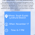
ALT Graphic promoting a safety talk that will be cohosted by NWS Cleveland and CCEMA on November 17.


ALT This graphic has an image of the local area showing high temperatures ranging from the upper 50s for northwest Pennsylvania and lower 60ss across northern Ohio. Today will be a very nice fall weather day with sunshine and blue skies expected today.

ALT This image shows a 5-day forecast. Enjoy the pleasant weather the next few days because the weather will deteriorate Wednesday night into the weekend as a strong cold front moves through the area. Expect widespread rain and windy conditions Thursday and Friday, mixing with snow at times. Gradually drying out Saturday, but still cold.

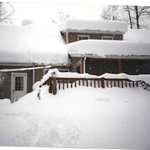
ALT This image shows the heavy snow accumulation at a house in Hambden Township, where 68.9 inches accumulated between November 9 and 14, 1996.

ALT This graphic has an image of the local area showing high temperatures ranging from the lower 50s for northwest Pennsylvania and middle to upper 50s across northern Ohio. There will be more sunshine further west over northwest and central Ohio today. More lake effect clouds than sunshine is expected today over far northeast Ohio and northwest Pennsylvania.

ALT This graphic has two images, the first shows the low temperature forecast for tonight which is in the upper 30s to low 40s. The second image shows the chance of precipitation which ranges from 20 percent in Lake and Geauga Counties up to 70 percent in Erie County Pennsylvania.

ALT 5 day forecast summary for northern Ohio and northwestern Pennsylvania. Today will be mostly sunny and breezy with highs 53 to 58 and lows tonight 37 to 44. A few showers are possible across Northeast Ohio and Northwest Pennsylvania on Monday with highs 49 to 55 and lows 34 to 42. Tuesday will be mostly sunny with highs 57 to 63 and lows 34 to 41. Clouds increase on Wednesday with rain arriving at night. Highs 55 to 60, lows 40 to 45. Thursday will be rainy and breezy, with snow possibly mixing in Thursday night. Highs 43 to 50, lows 33 to 40.

ALT This graphic shows a low temperature map across Northeast Ohio and Northwest Pennsylvania. Lows will generally be in the low to mid 30s with a few cooler valley locations and slightly warmer values near Lake Erie.

ALT Forecast highs today on the left, in the upper 40s and lower 50s. Rain chances today on the right, 60 to 100 percent east of Cleveland and north of Youngstown and quickly dropping off to near 0 farther west.


ALT Forecast highs today on the left, in the upper 40s and lower 50s. Forecast rain amounts through early Saturday on the right, less than one tenth of an inch for most of the area but increased to around half an inch across parts of far Northeast Ohio and Northwest Pennsylvania.

ALT Image depicting the forecasted conditions across the area tomorrow through Sunday Night.


ALT October weather statistics for Northern Ohio and Northwest Pennsylvania.

