

Exploring the world around me, inspiring others with what I find, and creating a lasting impact. Founder of TRACE, Inc. & TRACE Foundation.
Joined March 2010
- Tweets800
- Following1K
- Followers846
- Likes4.7K






Pinned Tweet
Finding Truth. Creating impact.
Explore. Find. Document. Impact.
Real People. Real places. Real stories.
TRACE goes where the story is. We explore remote places, find what's been overlooked, document it honestly, and turn it into impact.
Follow for more.
Today's Park News: Today it costs nothing to walk into a national park.
It's Veterans Day. For U.S. citizens and residents, entrance is free at every national park that charges a fee, and at national monuments and other Park Service sites too. Many national forests, wildlife refuges, BLM lands and Army Corps lakes are also free.
The NPS waiver covers all Park Service sites that charge an entrance fee, not just the national parks. That includes national monuments, historical parks, seashores and other NPS sites.
Also free today:
• Entrance at national wildlife refuges and other Fish and Wildlife Service lands that charge a fee
• Recreation fees at most Forest Service day use sites (concession sites may still charge)
• Standard amenity and day use fees on many BLM lands, including National Conservation Lands
• Day use fees at more than 2,850 Army Corps of Engineers recreation areas (boat ramps and swim beaches)
Get out there, enjoy the parks, and take a moment for the people who served.
#NationalParks #VeteransDay2026


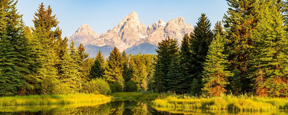
Sunrise on one of the historic barns of Mormon Row, with the Teton Range behind it. Homesteaders built them in the valley of Jackson Hole, and the Moulton barns here are among the most photographed barns in America. Photo: DASH713
Read my article on the history of Grand Teton National Park. Full story: #18 of 64, Grand Teton 👉 xitter.twitterapi.xyz/TRACE_/status/21205411…

2
11

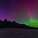
Grand Teton National Park, Wyoming. The northern lights over the Teton Range, photographed by a park photographer. Half the park is after dark: with little light pollution in the valley, the night sky here can be as good as the mountains. Photo: NPS/C. Adams
Read my article on the history of Grand Teton National Park. Full story: #18 of 64, Grand Teton 👉 xitter.twitterapi.xyz/TRACE_/status/21205411…
2
7


1. The Tetons reflected in String Lake at first light. Photo: NPS/Adams
2. Mount Moran above the Snake River at Oxbow Bend, one of the best wildlife-watching spots in the park, with moose, river otters, bald eagles and coyotes. Photo: Watts
3. Jenny Lake and the mouth of Cascade Canyon, carved by glaciers between the park's highest peaks. Photo: Acroterion
4. The heart of the range: Middle Teton, Disappointment Peak, Teepe Pillar and the Grand Teton, which tops out at 13,775 feet. Photo: Acroterion
Read my article on the history of Grand Teton National Park. Full story: #18 of 64, Grand Teton 👉 xitter.twitterapi.xyz/TRACE_/status/21205411…
2
8


Read my article on the history of Grand Teton National Park. Full story: #18 of 64, Grand Teton 👉 xitter.twitterapi.xyz/TRACE_/status/21205411…
2
6
Grand Teton National Park
(Today's Park Report & News)
Today, Veterans Day, entrance is free for U.S. citizens and residents at every national park that charges a fee, including Grand Teton. The park is open 24 hours a day, all year, but it's in its quiet season now. Since Nov. 1, the Teton Park Road has been closed to cars from the Taggart Lake Trailhead to Signal Mountain Lodge. Until snow covers it, you can walk, run or bike the closed road, and leashed pets are allowed on it. The park's elk reduction program, run with Wyoming Game and Fish, starts Nov. 14 and runs through Dec. 6 in Hunt Area 75. Those areas stay open to visitors, and the park asks you to wear bright colors. Fire crews may also be burning brush piles near Colter Bay, Beaver Creek, Elk Ranch and Kelly Pit, so you may see smoke.
Roads: The park's main highways are plowed and open all winter from Jackson to Flagg Ranch. Expect 20-minute delays south of Moran Junction for riverbank repair work. The Moose-Wilson Road is closed between the Laurance S. Rockefeller Preserve and Moose, and Death Canyon Road and Trailhead are closed to all use for construction. Secondary roads such as Antelope Flats and Schwabacher close as the weather turns. Construction pauses for the winter on Nov. 15.
Trails: The north segment of the Taggart Lake Trail is closed for reconstruction, but Taggart and Bradley lakes are still reachable by the southern route. Mormon Row is open, though some buildings are closed for construction. Black and grizzly bears are still active, even this late in the year, so hike in groups of three or more, make noise and carry bear spray.
Camping and fees: A private vehicle pass is $35, a motorcycle $30 and a walk-in or bicycle $20 per person, all good for 7 days. The park doesn't take cash. Non-U.S. residents 16 and older pay an extra $100 unless they hold an annual pass. All park campgrounds are closed for the season, as are the visitor centers, lodges and marinas. On Jackson Lake, the water is low and Signal Mountain is the only boat ramp open. NPS recommends hand launching there, at your own risk. The park keeps most of its entrance fees and spends about $9 million a year on roads, trails, pathways and habitat.
Best hike: Taggart Lake. NPS lists it at 3 miles round trip with 360 feet of gain, rated easy, about 1 to 2 hours. With the north segment closed for construction, plan on the southern route, about 4.25 miles round trip (Grand Teton National Park Foundation). AllTrails lists the Taggart Lake Loop at 3.8 miles and 426 feet of gain, with 4.8 stars from about 12,500 reviews. It's known for some of the best close-up views of the Teton Range: you climb an aspen-covered glacial moraine to a lake at the mouth of Avalanche Canyon. Tip: The trailhead sits just south of the road closure, so you can still drive to it. Once snow falls, bring snowshoes or skis.
Grand Teton quick facts:
-Became a national park: 1929.
-Known for: The Teton Range, which rises about 7,000 feet straight out of the valley of Jackson Hole with no foothills, topped by the 13,775-foot Grand Teton. The park also protects the Snake River, Jackson Lake and elk, bison, moose and pronghorn.
Seasonal closures: The Teton Park Road is closed to cars from Nov. 1 to April 30, and it's groomed for skiing and snowshoeing from mid-December to mid-March. The Moose-Wilson Road is closed from Nov. 1 until mid-May. The Deadmans Bar and Pacific Creek river launches close for winter wildlife on Dec. 15.
Best time to visit: May through September is the busy season, when the roads and facilities are open. Fall brings golden aspens and bugling elk. Winter is quiet, with sunny days between storms, frigid nights and snow over the valley.
Tip: Get to Mormon Row or the Snake River Overlook before sunrise. The range faces east, so first light turns the peaks pink and gold. Carry winter gear in the car, because snow can come in any month.
TRACE take: Grand Teton in November is the park with the crowds gone and the elk moving down from the high country. Go today while it's free, walk the empty Teton Park Road, and watch the light hit the range.

1
4
19
Read my article on the history of Grand Teton National Park. Full story: #18 of 64, Grand Teton 👉 xitter.twitterapi.xyz/TRACE_/status/21205411…
2
4
Grand Teton National Park
(Today's Nonprofit Conservation Report)
Grand Teton National Park Foundation raises private money for projects the park's budget can't fully cover. It says it has raised more than $150 million to strengthen and sustain the park.
Much of that money goes to trails. Its biggest current project with the park is Reimagining Taggart Lake, a multi-year rebuild of one of the park's busiest hikes. Crews are fixing years of erosion, improving drainage and laying stone and gravel surfaces on the steep sections. Once this phase is done, the trail to the first bridge will be accessible to visitors using frontcountry wheelchairs. The nearby Cottonwood Creek Picnic Area is being rebuilt with a shade structure and an accessible surface.
In the backcountry, the Foundation has supported a multi-year renewal of the Teton Crest Trail. This summer, crews reshaped and drained a section near Marion Lake that hadn't been worked on in over a decade. The Foundation also committed to raising $61,200 for the first phase of work at Delta Lake, where social media and GPS apps turned a remote, trail-free spot into a place hundreds of hikers visit a day. Access Fund and park crews, with local volunteers and Jenny Lake rangers, pulled a tangle of eroding paths into one route.
A second partner helps too. Grand Teton Association is a 501(c)(3) nonprofit that runs park stores and gives 100% of its store profits back to public lands in the Teton region, supporting education, interpretation and research.
TRACE take: Popularity wears a park out, one footstep at a time. At Grand Teton, the people who love it are paying to rebuild the trails they walk on.

1
2
20
Read my article on the history of Grand Teton National Park. Full story: #18 of 64, Grand Teton 👉 xitter.twitterapi.xyz/TRACE_/status/21205411…
2
6

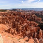
Inspiration Point in early morning light, looking down into the Silent City, the densest maze of hoodoos in the Bryce Amphitheater. Frost carves them: water freezes in the cracks and thaws again on more than 170 nights a year. Photo: King of Hearts
Read my article on the history of Bryce Canyon National Park. Full story: #17 of 64, Bryce Canyon 👉 xitter.twitterapi.xyz/TRACE_/status/21201830…

1
10

Bryce Canyon National Park, Utah. The amphitheater after a snowfall. The rim sits at roughly 8,000 to 9,000 feet, so winter comes early here, and the red rock under fresh snow is one of the best sights in the park. Photo: Emanuel Hahn, CC0, via Wikimedia Commons
Read my article on the history of Bryce Canyon National Park. Full story: #17 of 64, Bryce Canyon 👉 xitter.twitterapi.xyz/TRACE_/status/21201830…
1
8


1. The Bryce Amphitheater in morning light from Sunrise Point. Photo: Christian David
2. The view from Bryce Point, the southern end of the amphitheater and the start of the Peekaboo Loop. Photo: King of Hearts
3. Natural Bridge, an arch carved into the red rock, seen from its overlook on the scenic drive. Photo: Christian David
4. Hoodoos along the Queen's Garden Trail, the easiest trail down into the amphitheater, 1.8 miles round trip to the Queen Victoria hoodoo. Photo: Fabio Achilli
Read my article on the history of Bryce Canyon National Park. Full story: #17 of 64, Bryce Canyon 👉 xitter.twitterapi.xyz/TRACE_/status/21201830…
1
8


1. Snow on the rim and slopes of the Bryce Amphitheater. Photo: KadenMP
2. A capped hoodoo above a snowy amphitheater. Its harder cap rock shields the softer stone underneath, which is why it still stands. Photo: Bigwiggy
3. Agua Canyon Overlook after a fresh snow, with snow-covered peaks on the horizon, on the scenic drive toward Rainbow Point. Photo: Christian David
4. Hoodoos in the Fairyland area at the park's north end, where the 8-mile Fairyland Loop drops below the rim. Photo: Frypie
Read my article on the history of Bryce Canyon National Park. Full story: #17 of 64, Bryce Canyon 👉 xitter.twitterapi.xyz/TRACE_/status/21201830…
1
7
Bryce Canyon National Park
(Today's Park Report & News)
Bryce Canyon is open 24 hours a day with no entry reservation, and tomorrow is a good day to go: Veterans Day, Nov. 11, is an entrance fee-free day for U.S. citizens and residents at every national park that charges a fee. On the trails, Wall Street and the Bryce Connector Trail (Bryce Point to the Peekaboo Loop) are closed until further notice after recent weather. Other trails are open, but NPS warns that freezing nights make rockfall more likely during the day. The park also has a new way to Bryce Point: the final 2.7-mile segment of the paved, 24-mile Shared Use Path is done, linking Bryce Point to Red Canyon in Dixie National Forest, with stops at the visitor center, Sunrise, Sunset and Inspiration points, the lodge and both campgrounds.
Roads: The main park road is open. Storms can close roads until plows clear them, so check the park alerts and UDOT before you drive. The free shuttle ended for the season on Oct. 20, so bring your own car or bike. Bikes are allowed on the Shared Use Path but not on the Rim Trail or at the overlooks.
Trails: The Navajo Loop's Two Bridges side stays open in winter while Wall Street is closed. Queen's Garden, the Rim Trail, Peekaboo Loop and Fairyland Loop are open. The backcountry Under-the-Rim Trail is badly deteriorated in many places, so hike it only with strong navigation skills, knowing rescue may be slow.
Camping and fees: A private vehicle pass is $35, a motorcycle $30 and a walk-in or bicycle $20 per person, all good for 7 days. The park doesn't take cash, so bring a card. Non-U.S. residents 16 and older pay an extra $100 unless they hold an annual pass. North Campground is open all year by reservation at $30 a night, and Sunset Campground is closed for the winter. The dump station is closed for the season and the drinking fountains are being winterized, so fill up before you come. The visitor center is on winter hours, 8 a.m. to 4:30 p.m. daily.
Best hike: Queen's/Navajo Combination Loop, 2.9 miles round trip with 625 feet of gain, rated moderate, about 2 to 3 hours (NPS). AllTrails lists it at 3 miles and 629 feet of gain, with 4.9 stars from about 37,000 reviews. It's known as the park's most popular hike and the one rangers recommend to first-time visitors: down Queen's Garden from Sunrise Point among the hoodoos, then up the Navajo Loop switchbacks to Sunset Point, and back on the Rim Trail. Tip: With Wall Street closed, climb out on the Two Bridges side, and hike it clockwise as NPS recommends.
Bryce Canyon quick facts:
-Became a national park: 1928.
-Known for: The greatest concentration of hoodoos on Earth, carved from the Claron Formation by frost and rain. The rim climbs to 9,115 feet at Rainbow Point, and the park is a certified International Dark Sky Park.
Seasonal closures: Wall Street closes in winter. Sunset Campground is closed for the season, and the shuttle and dump station are done for the year. The visitor center closes on Christmas Day and closes early on Christmas Eve.
Best time to visit: May through September is the busiest season. Fall and winter are quieter, with low light on the hoodoos and snow on the rim, but nights drop below freezing nearly every night from October to May.
Tip: Get to Sunrise Point or Inspiration Point early. The amphitheater faces east, so first light turns the hoodoos orange. Once snow falls, carry traction for your boots on the steep trails into the canyon.
TRACE take: Bryce in November gives you the park's best light with a fraction of the summer crowd. Go tomorrow while it's free, watch sunrise from the rim, then walk down among the hoodoos on Queen's Garden.

2
3
33
Read my article on the history of Bryce Canyon National Park. Full story: #17 of 64, Bryce Canyon 👉 xitter.twitterapi.xyz/TRACE_/status/21201830…
1
4
Bryce Canyon National Park
(Today's Nonprofit Conservation Report)
Bryce Canyon Association is the park's official nonprofit partner. It's a 501(c)(3) that runs the bookstore in the visitor center and supports both Bryce Canyon National Park and Dixie National Forest. Since 1961, it has provided more than $9 million in support.
That money goes to things the park's regular budget doesn't cover well. The association pays for the free Hoodoo newspaper and hiking maps, the Junior Ranger program, and the park's annual Astronomy and Geology festivals. It funds wildlife studies on mountain lions, black bears and the threatened Utah prairie dog, supports the Christmas Bird Count, and pays for interns who help with visitor services and geology. It also funds geologic hazard mapping, which matters in a park where freezing nights loosen rock on the trails, and the Kwiyamuntsi Youth Camp.
Two other partnerships help. The Lodge at Bryce Canyon and Ruby's Inn run a $1 donation program, where guests can give a dollar each night they stay. It has raised more than $900,000 to pay for seasonal employees and visitor services. And Southern Utah University's Alliance for Education with the park sends students out on conservation crews and internships.
The trail need is real. NPS says the backcountry Under-the-Rim Trail has deteriorated in many places, and Wall Street and the Bryce Connector Trail are closed right now after recent weather.
TRACE take: Bryce's hoodoos are always falling apart, and that's how they're made. Keeping the trails, maps and science going around them falls to a bookstore nonprofit, some hotel guests giving a dollar a night, and students willing to work.

2
3
30
Read my article on the history of Bryce Canyon National Park. Full story: #17 of 64, Bryce Canyon 👉 xitter.twitterapi.xyz/TRACE_/status/21201830…
2
5

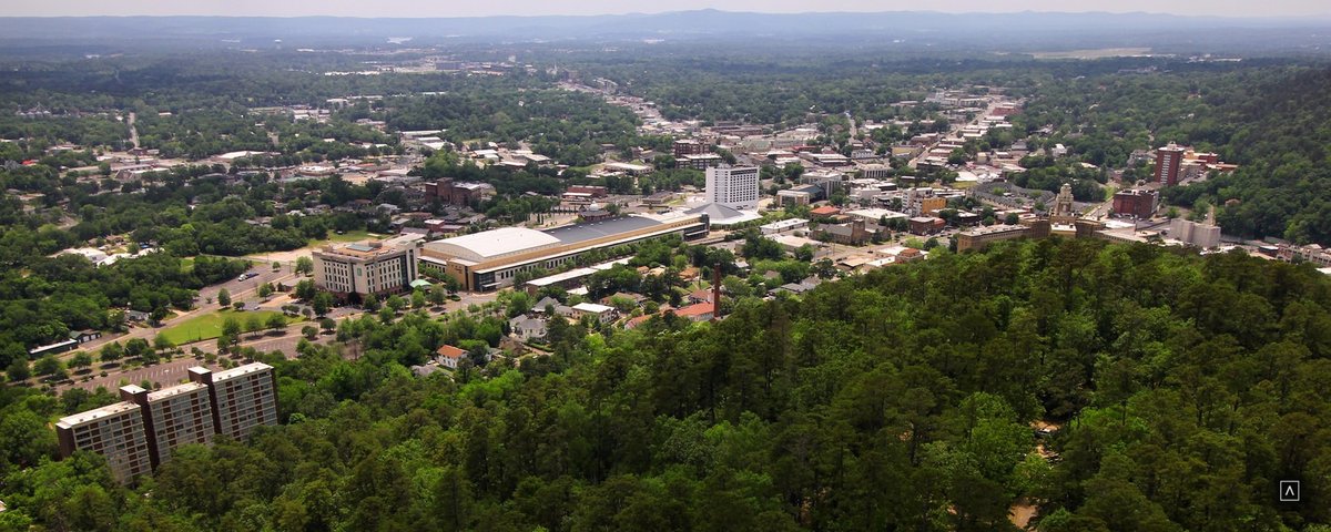
Goat Rock View Point on North Mountain, where novaculite outcrops look out over the forested Ouachita ridges that feed the park's hot springs. Photo: Larry D. Moore
Read my article on the history of Hot Springs National Park. Full story: #16 of 64, Hot Springs 👉 xitter.twitterapi.xyz/TRACE_/status/21198164…
2
31

Hot Springs National Park, Arkansas. Thermal water steaming down the slope of Hot Springs Mountain, where the park's springs rise. It comes out of the ground at about 143°F after roughly 4,400 years underground. Photo: Max Wolfe
Read my article on the history of Hot Springs National Park. Full story: #16 of 64, Hot Springs 👉 xitter.twitterapi.xyz/TRACE_/status/21198164…
2
21


1. The historic entrance to the reservation and the Stevens Balustrade, the stairway between the Fordyce and Maurice bathhouses that climbs to the Grand Promenade. Photo: Brandonrush
2. The Ozark Bathhouse, now home to Mystic Ozark, a hands-on museum about the park's thermal water. Photo: Larry D. Moore
3. The Hale, the oldest bathhouse on the row, now a hotel and restaurant. Photo: Larry D. Moore
4. The Grand Promenade, the brick walkway behind Bathhouse Row and the gateway to the park's mountain trails. Photo: Eric Friedebach
Read my article on the history of Hot Springs National Park. Full story: #16 of 64, Hot Springs 👉 xitter.twitterapi.xyz/TRACE_/status/21198164…
2
28


1. Looking north from the Hot Springs Mountain Tower, whose open-air deck sits 1,256 feet above sea level with a view of about 140 square miles. Photo: Larry D. Moore
2. The view from West Mountain Summit Drive. The summit loop has three overlooks and an outcrop of novaculite, the hard stone people quarried here for tools for thousands of years. Photo: Larry D. Moore
3. One of the park's historic stone trail shelters, a shaded rest stop on the mountain trails. Photo: Larry D. Moore
4. Gulpha Creek at Gulpha Gorge, the park's campground, open all year. Photo: Larry D. Moore
Read my article on the history of Hot Springs National Park. Full story: #16 of 64, Hot Springs 👉 xitter.twitterapi.xyz/TRACE_/status/21198164…
2
18