
Atmospheric Scientist/AI Professional/Certified Consulting Meteorologist
Joined June 2026
- Tweets473
- Following105
- Followers1.2K
- Likes795


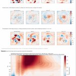


Global mountain torque just smashed the old record in my CORe analysis going back to 1968, exceeding it by a full standard deviation! East Asia and the Andes supplied most of the positive torque, transferring angular momentum from the solid Earth to the atmosphere as the AAM tendency carried the GWO trace off the right edge of the phase diagram. Twin upper-level anticyclones over the eastern tropical Pacific are consistent with persistent El Niño heating, while strong Pacific westerlies in both hemispheres help guide vigorous downstream Rossby wave dispersion.
Synoptic dynamics appear to be driving the next round of ridge growth. Around Nov. 19–21, ECMWF and its ensembles predict higher-θ air extending poleward along the dynamic tropopause on the eastern flank of a Pacific trough as the ridge amplifies over western Canada. Some guidance extends the ridge into Alaska. An active Pacific storm track could continue beneath the ridge, and the reach/intensity of any cold surge will depend on the downstream trough and the quality of the cold air it can tap. If the stratospheric disturbance couples more strongly to the troposphere, it could favor more persistent high-latitude ridging later in November and into December.


Oh and I need once again to thank @burgwx for his excellent model graphics, which is where I got the tropopause map. Love the DT plots!

Next week’s cold outbreak and the potential for a late-week nor’easter fit a broader circulation transition associated with a westward reorganization of tropical convective forcing within the persistent El Niño background. Changes in the associated upper-level divergent outflow help reshape Rossby-wave forcing of the Pacific jet. The AIFS ensemble forecast depicts downstream wave-energy dispersion and an amplified ridge–trough pattern across North America, favoring cold-air delivery into the eastern United States and an environment supportive of coastal storm development. Whether a significant nor’easter develops will depend on the timing and interaction of individual disturbances. You can diagnose such sensitivities quite effectively using @burgwx’s excellent website, specifically ESA: polarwx.com/esa.
This transition follows a sharp decline in global atmospheric angular momentum (AAM), associated with the negative phase of a friction–mountain torque cycle. AAM nevertheless remains above normal, consistent with the broader El Niño circulation. The ensembles now predict a pronounced positive mountain-torque spike and a rapid AAM recovery, suggesting another circulation adjustment is already underway. If accompanied by renewed Pacific jet extension and downstream progression of the North American wave pattern, that adjustment would favor a relatively brief eastern cold spell and a return to much milder conditions after the potential storm.
The ongoing sudden stratospheric warming adds uncertainty to the outlook later in November and beyond. Ensemble guidance retains a substantial lower-stratospheric signal, keeping open the possibility of downward coupling over the coming weeks. If that coupling develops, it could favor high-latitude blocking and a more negative Arctic/North Atlantic Oscillation, increasing opportunities for renewed cold outbreaks where the regional circulation supports them. A post-storm warmup therefore remains plausible, although confidence in a sustained return to mild conditions is lower. The timing and geographic distribution of any stratospheric influence remain uncertain, and next week’s cold and storm potential are more directly explained by the evolving tropospheric wave pattern.
You can do your own diagnosis of the weather-climate situation at gsdmsolutions.com.


Numerical weather forecasts put probabilities on future outcomes; diagnosis helps us scrutinize the pathways towards them. On Wednesday November 4, Week 3-4 temperature and precipitation forecasts join GSDM Weather Services, accompanied by a full verification scorecard. gsdmsolutions.com/blog/week-…

Following up on my previous announcement that gsdmsolutions.com will soon feature a page devoted to SSW events and the causal chain in which they’re embedded, I have created a new free post: understanding the predicted SSW, from cause to consequence.
El Nino’s eastern Pacific forcing —> wave train —> Russian ridge —> SSW event. Yet the subseasonal forecast is “El Nino-fueled” mild weather, nearly the mirror image of what often follows SSW events that impact tropospheric winter weather.
gsdmsolutions.com/blog/ssw-n…
In development at gsdmsolutions.com: a new SSW monitoring page. Most views stop at “will the polar vortex break down/westerlies reverse?” This one lets you examine the event drivers and how likely it is to impact sensible weather. We try to lay out the whole causal chain: wave forcing from the troposphere, the vortex response and the way back down: anomaly descent, tropospheric coupling and high-latitude blocking. Included are days 1-15 forecasts from AIFS-ENS and 101-member ECMWF 46-day extended range ensemble, centered on the model’s own climate. Finally we leverage our 58-year CORe archive for historical context.

New on gsdmsolutions.com for Professional subscribers: the Extreme Event Browser. Pick a hazard like US West Coast atmospheric rivers, CONUS extreme snowfall, global cold spells, global heavy-precip days, a GSDM state (GWO, MJO or NH latitude band AAM), and a lead window.
Each map shows where event onsets become more or less frequent after that state, over 58 winters, with a false discovery rate test and the sample size behind every map. These are historical associations. Find it under Composite —> Extreme Events.

Strong El Niño forcing, helping maintain a high AAM background state, continues to influence the global circulation and storm tracks. Persistent central-eastern tropical Pacific heating favors a wave-pattern reorganization supporting another deep southwestern/western U.S. trough - raising Rockies snow and southern Plains severe weather/heavy rain risks again, probably late next week. You can diagnose all of this and suss out forecast implications at gsdmsolutions.com.


Curious how the current potent El Niño is showing up on subseasonal time scales? We’ve just launched GSDM Workflows: guided playbooks for reading the GSDM diagnostics, from AAM and torques to the MJO. Start with the free Canonical Tour: gsdmsolutions.com/blog/gsdm-….
Classic tropical tornado environment over the Southeast US today. Isaias remnants are interacting with a robust synoptic-scale system/mid-level trough. This has allowed appreciable conditional instability and substantial lower tropospheric SRH to colocate with baroclinic zones, supporting rotating updrafts.


4
565
As surmised earlier this summer, the GWO has remained firmly in the El Niño attractor and is poised to transit phases 7-8 as the tendency becomes negative. While this favors a western ridge aloft, one is situated over central NOAM. My read is that the Pacific wave train is interacting with persistent, east-shifted El Niño large-scale tropical heating, perhaps reinforcing downstream wave activity and amplifying the ridge further east.


El Nino’s prodigious subseasonal fingerprint is once again trolling the y-axis in the latest forecast.


7
551
A new capability coming soon to gsdmsolutions.com: a way to explore subseasonal model skill and its relationship to the evolving global atmospheric state.
gsdmsolutions.com/blog/subse…
New at gsdmsolutions.com: (1) Pentad-mean (1-5, 6-10 and 11-15 day) forecast maps from the AIFS-ENS. I have started by generating these for the compound maps showing WAF, waveguides, psi200’ and chi200’ and (2) forecast verification for AAM, VPM, Tauf and TauM.
On today’s forecast sequence you can see the modeled westward shift in the intense large scale wave number 1 chi200’ field with attendant renewed strong forcing of Rossby wave trains in both hemispheres.
The maps use stippling/hatching to show areas of reduced ensemble signal-to-noise in the psi200’ & chi200’ fields.


