

Join us as we explore the worlds of our solar system.
- Tweets9.9K
- Following140
- Followers3M
- Likes11.3K




ALT Images from Discovery Program missions (left to right): 1. Mercury was produced using images from the color base map imaging campaign during MESSENGER's primary mission 2. Dwarf planet Ceres shown in enhanced-color renderings that use images from NASA’s Dawn mission 3. NASA's Gravity Recovery and Interior Laboratory (GRAIL)'s gravity map of the Moon 4. NASA's InSight lander is in the foreground in this view from its landing site on Mars 5. A portion of the irregularly shaped asteroid Donaldjohanson as seen by NASA’s Lucy spacecraft 6. Mars appears as a thin pink crescent in this view from NASA’s Psyche spacecraft




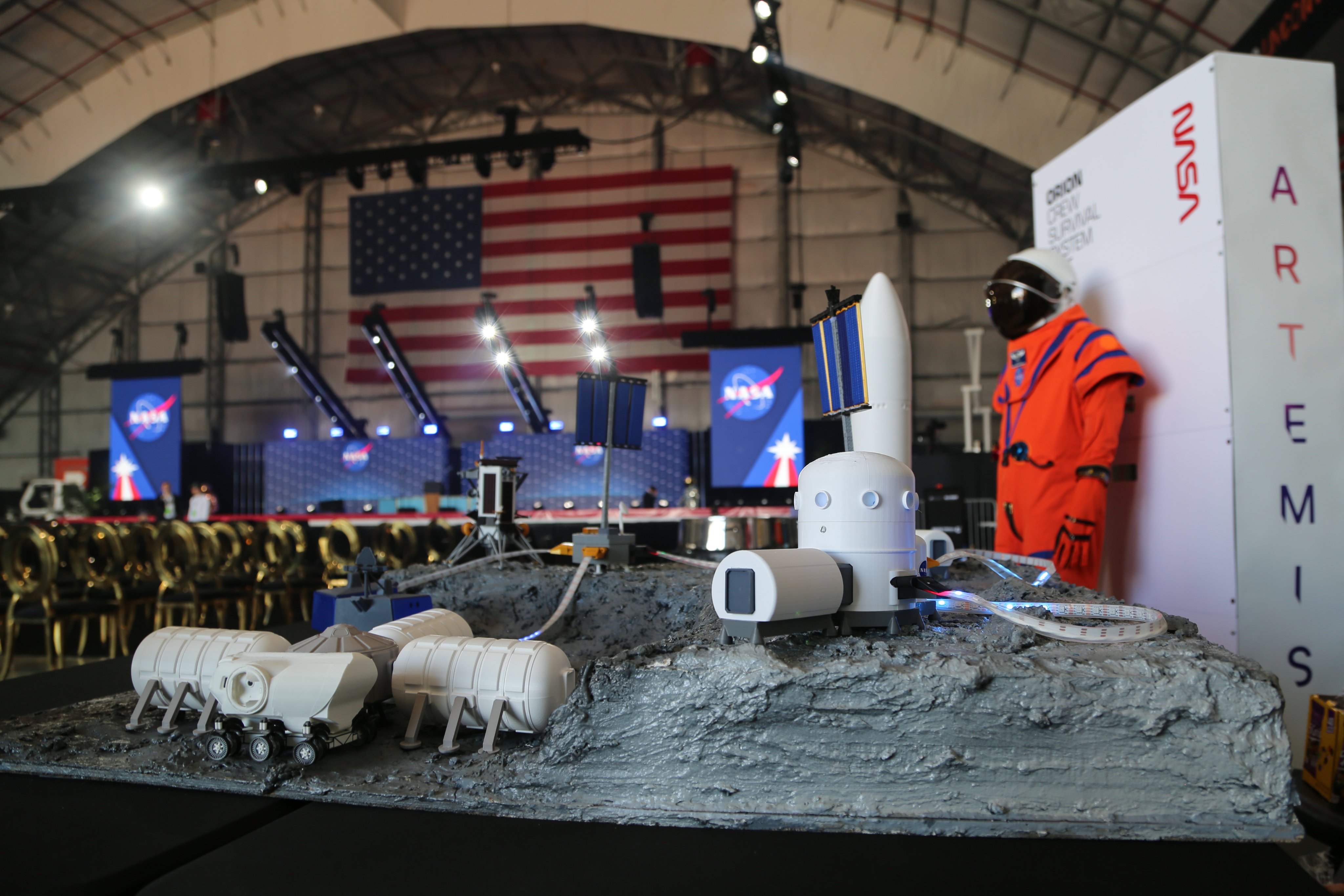
ALT A NASA exhibit at UP.Summit during MAX POWER on Nov. 6, 2026, features a conceptual lunar surface display illustrating the power infrastructure needed to support longer-duration missions on the Moon. In the foreground, miniature habitation modules and other lunar surface assets sit atop a gray, rocky terrain model, demonstrating how infrastructure could support sustained lunar exploration. The display is illustrative and does not represent a finalized Moon Base design. Behind the model stands an orange Orion Crew Survival System suit, with a stage and large American flag visible in the background. Credit: NASA/Briana Zamora


ALT Two strips of inky black solar arrays cross diagonally over the scene. In the background is a stark white clean room. A technician in clean room attire is inspecting the hardware in the foreground. Credit: BAE Systems Space & Mission Systems

ALT Simulated night sky from NASA Goddard in Greenbelt, Maryland, looking southeast at 11 p.m. EST on Nov. 6. A teal arc traces the path of the first ESCAPADE spacecraft. It rises from the eastern horizon, peaks high in the south around midnight, and sets in the west by 3:30 a.m., with hourly time labels along the way. A marker shows the spacecraft about halfway up the southeastern sky at 11 p.m. Orion, Aldebaran, Procyon, Sirius and Saturn are labeled for reference.

ALT Simulated night sky from NASA Goddard in Greenbelt, Maryland, looking southeast at 11 p.m. EST on Nov. 8. A teal arc traces the path of the second ESCAPADE spacecraft. It rises from the eastern horizon, peaks high in the south around 1 a.m., and sets in the west by 4:15 a.m., with hourly time labels along the way. A marker shows the spacecraft about halfway up the southeastern sky at 11 p.m. Orion, Pollux, Procyon, Sirius and Saturn are labeled for reference.

ALT Hera 'selfie' of its top level Asteroid Deck, taken by its corner Spacecraft Monitoring Camera. The image (left to right) shows the Chicxu the dinosaur sticker on the multi-layer insulation baffle covering the Laser Rangefinder, one of its Asteroid Framing Camera its two startrackers and its Thermal Infrared Imager.


ALT A graphic that says "14 Challenges" and features the NASA Space Apps Challenge logo and five photos that shows the Moon and a rocket, the Earth from space, a night-time view of the sky, the surface of Mars, and another view of the Earth from space.

ALT A graphic that says: "Challenge - Flame in Freefall: SI-Powered Fire Safety Insights from Microgravity Combustion Data. For decades, NASA has studied how flames and fire behave in microgravity, gathering a trove of experimental data along the way. That knowledge matters more than ever as humans gear up to return to the Moon and press on to Mars, yet the volume of results makes them hard to find, compare, and understand. Your challenge is to create an interactive, SI-powered dashboard that summarizes, ranks, and interprets those findings to deliver fire safety insights for human space exploration."

ALT A close-up view of the Moon captured by an Artemis II crewmember using an iPhone on April 6, 2026, during flight day six of the mission. The image reveals the Moon’s rugged, gray-white surface, covered in countless impact craters of varying sizes. Some areas appear relatively smooth, while others are densely packed with overlapping craters. Along the right edge, sunlight casts deep shadows across the cratered terrain, sharply contrasting with the blackness of space. Credit: NASA


ALT Simulated night sky from NASA Goddard in Greenbelt, Maryland, looking southeast at 11 p.m. EST on Nov. 6. A teal arc traces the path of the first ESCAPADE spacecraft. It rises from the eastern horizon, peaks high in the south around midnight, and sets in the west by 3:30 a.m., with hourly time labels along the way. A marker shows the spacecraft about halfway up the southeastern sky at 11 p.m. Orion, Aldebaran, Procyon, Sirius and Saturn are labeled for reference.
ALT Simulated night sky from NASA Goddard in Greenbelt, Maryland, looking southeast at 11 p.m. EST on Nov. 8. A teal arc traces the path of the second ESCAPADE spacecraft. It rises from the eastern horizon, peaks high in the south around 1 a.m., and sets in the west by 4:15 a.m., with hourly time labels along the way. A marker shows the spacecraft about halfway up the southeastern sky at 11 p.m. Orion, Pollux, Procyon, Sirius and Saturn are labeled for reference.

ALT An illustration of one of NASA’s twin Voyager probes against an abstract purple and blue background that gives the impression of deep space. Voyager has a white, upturned dish atop a black cylindrical body. A long antenna extends from the body toward the upper left and other shorter hardware protrudes from the sides and bottom. The image is watermarked “Artist’s concept” and “Credit: NASA/JPL-Caltech.”